About the Assembly
The Bia East District Assembly is the highest political and administrative authority in the district, with its capital at Adabokrom in the Western North Region, Republic of Ghana.
General Introduction
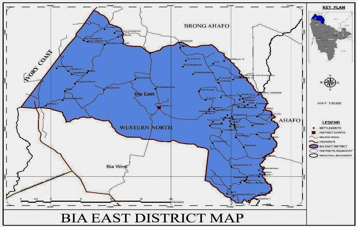
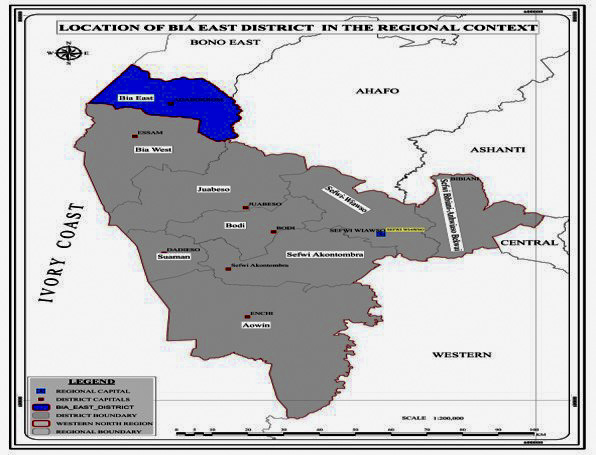
The Bia East District was carved out of the former Bia District in 2012 by Legislative Instrument (L.I) 2014 and was officially inaugurated in June 2012 with Sefwi Adabokrom as the district capital. The district is located in the north-eastern part of the Western North Region of Ghana. It shares boundaries with Dormaa West District to North, Asunafo South Districts to the North-East, La Cote d’Ivoire to the West, and Bia West District to the South-West. The district total land area is about 795k which is about 3.1% of the total land area of the Western North Region.
What the Assembly does
The Bia East District Assembly performs such functions as conferred on all Metropolitan, Municipal and District Assemblies by the Local Governance Act 2016 (Act 936). These include:
Local governance
Exercise deliberative, legislative and executive functions within the district as provided by the Local Governance Act, 2016 (Act 936).
Development planning
Prepare and implement the Medium Term Development Plan, annual action plans and the composite budget of the district.
Revenue and accountability
Mobilise district revenue, manage the District Assembly Common Fund and publish accounts and progress reports.
Service delivery
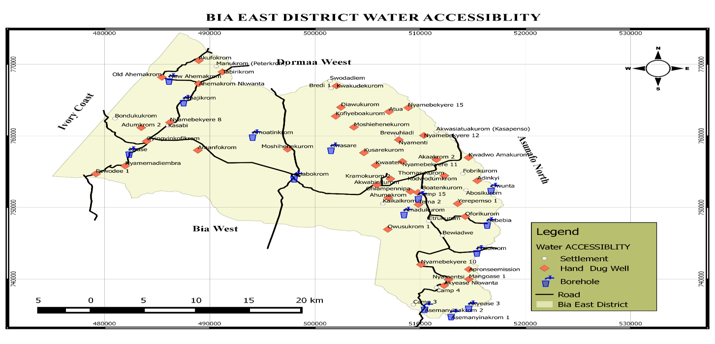
Coordinate departments to provide basic services in water, sanitation, education, health, agriculture and local economic development.
Population
Communities
Sq. Km
Years
The district covers an area of about 795 square kilometers.
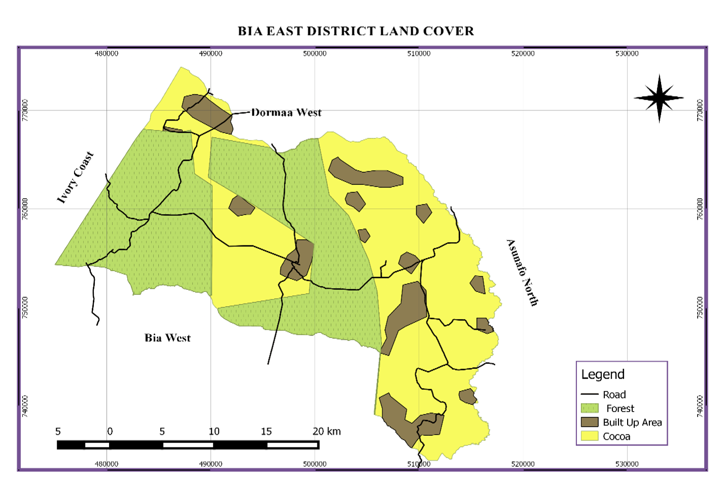
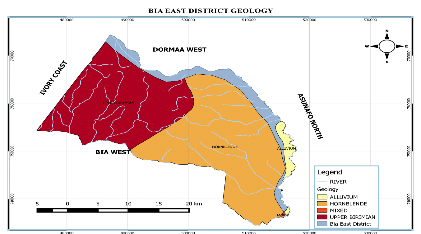
The geology of district is a combination of granitoid undifferentiated and phyllite, schist, tuff and greywacke, which contains the mineral bearing rocks. There are also granite rocks of minerals such as gold which have been discovered but are yet to be mined. The water table is good and has no salt content on groundwater. It is the reason why the district is able to provide water systems at a relatively moderate cost.
The presence of mineral deposits in the district has the potential to generate royalties as revenue to the District Assembly and also create employment for the inhabitants.
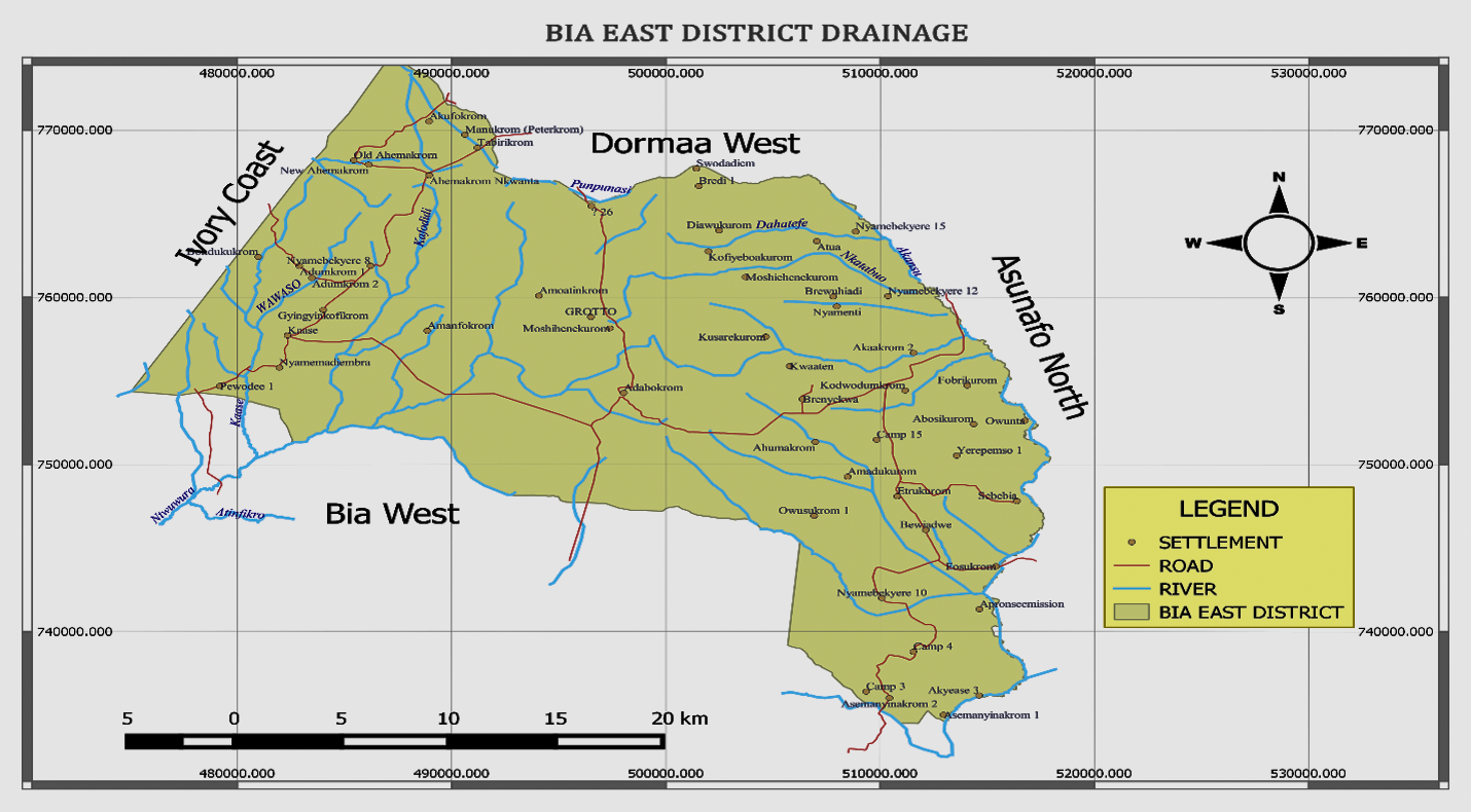
The district is endowed with a number of rivers and streams. Notable among these rivers and streams are the Ntwewura and Gyaametan rivers. The streams and rivers show a dendritic pattern, which forms the Bia Basin. The relief and drainage systems favours the development of fish farming, cultivation of rice, sugarcane and dry season vegetables.
Land, people & livelihoods
Visit us & have a Tour in our forest Reserve. Experience the natural setting in the Bia Forest Reserve
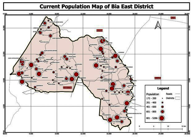
Bia East District’s population according to the 2021 PHC was 50,073 with more males (28,154), representing 53.0 percent than females (24,919) constituting 47.0 percent. The average population growth rate is about 2.1% as compared to the regional and national figures of 2.0% and 2.1% respectively. The total household population is 53,045 with males constituting 28,137 and females 24,908. The total non-household population for both sexes was 28 (17 males and 11 females). The 53,073 total population constitutes 6.0% share of population of the Western North Region. The projected current population is 57,674 comprising 30,567 (53%) males and 27,107 (47%) females.
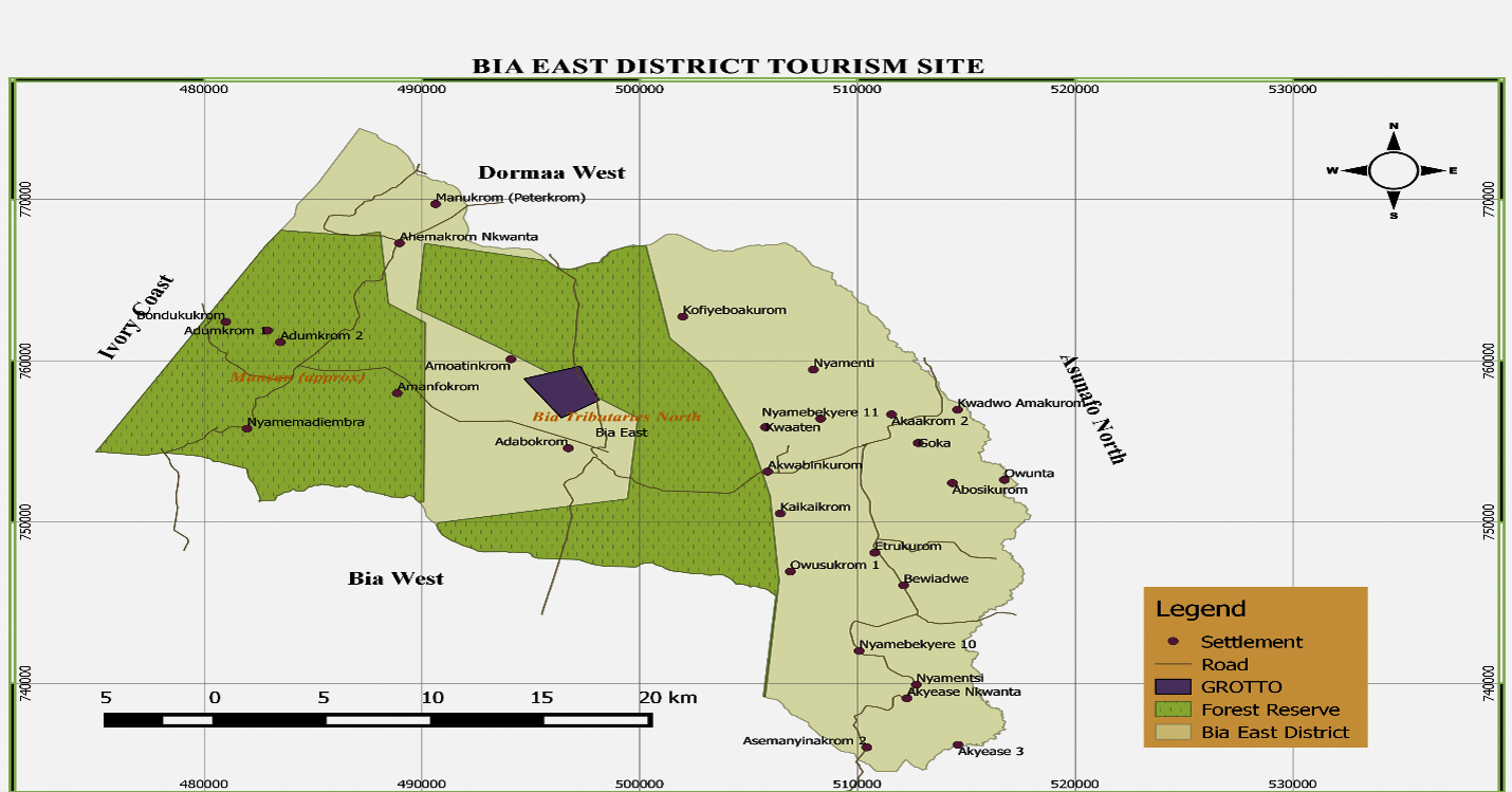
The district can boast of a tourist site at Adabokrom. This tourist site is called Adabokrom Grotto. In Adabokrom Grotto, you can find big rocks of different kinds having attractive shapes. It was discovered and developed by the Catholic Church. People of different faiths come from all parts of the country and beyond to pray. The place is seen as sacred, seclusion and symbolic links between heaven and earth, making it ideal for prayers and spiritual reflection. This spiritual exercise takes place in August every year. Apart from the spiritual needs, it boosts the local economy within the period and creates social cohesion.
The district is also endowed with eco-tourism such as Bia Tributaries and Manson Forest Reserve with different species of trees and animals.
In spite of the huge tourism potential, there is less investment in the sector. Infrastructure leading to the and at tourist destinations is not developed. There is also less marketing and promotion of the tourist destinations in the district. it calls for private sector participation to develop the available potential sites, improve tourism infrastructure including road networks leading to the sites
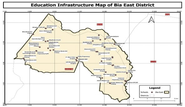
Social Services of the district include education, health care, nutrition, child and social protection, water, and housing. These are necessities for quality living standards and the performances of the development interventions have been reviewed and implications for the development of the district discussed.
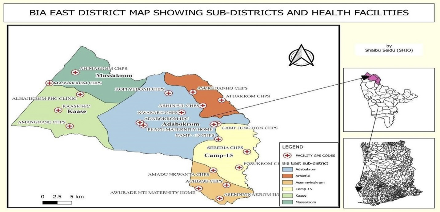
Health infrastructure
There are twenty-two (22) health facilities comprising 15 CHPS compounds, 3 Health Center, 2 Private Maternity Homes, 1 private health center and 1 clinic in the district. 18 of them are public health facilities and 4 are private health facilities. There are also 32 demarcated CHPS zones of which 18 are functioning. Bia East District has no district hospital.
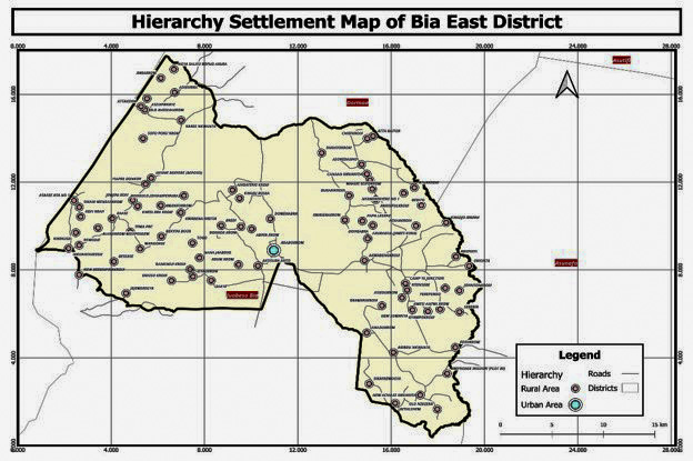
The majority of district inhabitants live in isolated hamlets and cottages, preferably on their farms. Thus, the general settlement pattern of the district can best be described as dispersed type. This dispersed settlement pattern makes it difficult to provide essential social services to most people in the district.
Currently, the district has no spatial development framework and structure plan. However, the district assembly collaborated with the regional LUSPA and GIZ and prepared draft local plans for Adabokrom and camp 15 Junction. Unfortunately, the local plans could not be finalized because of funding challenges. This makes it difficult for the assembly to control development in the district.
Haphazard land development and construction activities with no regard to the department of physical planning office and building regulations continue simply because the major towns in the district have no planning schemes. This is a serious challenge to settlement planning and development control in the district.
Lack of spatial development plans, structure plans and local plans; non-compliance with zoning regulations and planning standards; weak enforcement of building regulations; inadequate knowledge on spatial planning issues, incomplete street naming and property addressing system remain as challenges with spatial development and management.
The haphazard development of infrastructure makes it difficult to effectively manage domestic fires, floods, construct water systems and extension of electricity.